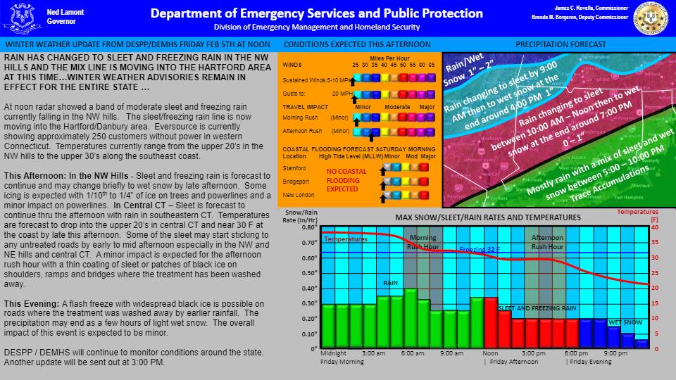
| RAIN HAS CHANGED TO SLEET AND FREEZING RAIN IN THE NW HILLS AND THE MIX LINE IS MOVING INTO THE HARTFORD AREA AT THIS TIME…WINTER WEATHER ADVISORIES REMAIN IN EFFECT FOR THE ENTIRE STATE …
At noon radar showed a band of moderate sleet and freezing rain currently falling in the NW hills. The sleet/freezing rain line is now moving into the Hartford/Danbury area. Eversource is currently showing approximately 250 customers without power in western Connecticut. Temperatures currently range from the upper 20’s in the NW hills to the upper 30’s along the southeast coast.
This Afternoon: In the NW Hills - Sleet and freezing rain is forecast to continue and may change briefly to wet snow by late afternoon. Some icing is expected with 1/10th to 1/4” of ice on trees and powerlines and a minor impact on powerlines. In Central CT – Sleet is forecast to continue thru the afternoon with rain in southeastern CT. Temperatures are forecast to drop into the upper 20’s in central CT and near 30 F at the coast by late this afternoon. Some of the sleet may start sticking to any untreated roads by early to mid afternoon especially in the NW and NE hills and central CT. A minor impact is expected for the afternoon rush hour with a thin coating of sleet or patches of black ice on shoulders, ramps and bridges where the treatment has been washed away.
This Evening: A flash freeze with widespread black ice is possible on roads where the treatment was washed away by earlier rainfall. The precipitation may end as a few hours of light wet snow. The overall impact of this event is expected to be minor.
DESPP / DEMHS will continue to monitor conditions around the state. |